Agartala (Tripura) July 8: The India Meteorological Department (IMD) has issued a Red Alert for South Tripura District in view of the forecast of extremely heavy rainfall over the next 24 hours; District Administration, South Tripura informed citizens in a social media post today.
“This alert indicates a very high likelihood of widespread heavy to extremely heavy rainfall, flash floods, riverine flooding, and landslides in vulnerable areas. The District Administration urges all residents to remain extremely vigilant. Weather conditions are expected to deteriorate rapidly, with strong winds, continuous rain, and the risk of waterlogging in urban areas and inundation of low-lying regions”, the post read.

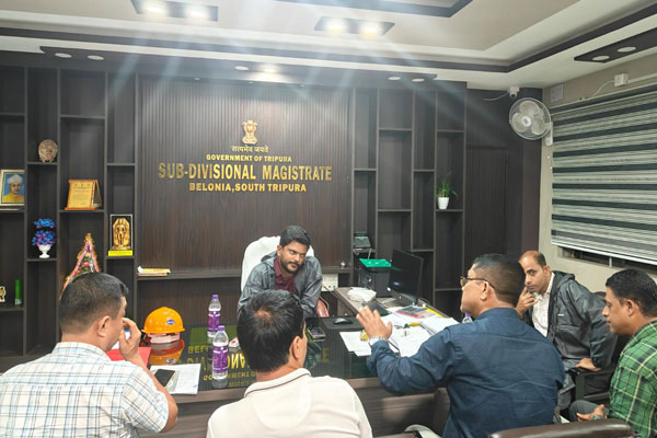
To combat the prevailing situation, the District Magistrate & Collector of South Tripura chaired an emergency meeting to review and strategize proactive measures in light of the probable flood situation arising from incessant rainfall. Coordination among departments and immediate response mechanisms were key points of discussion.
As part of the disaster management, the 9th Battalion TSR (DM) has been mobilized to the SBM SDM Office to support ongoing flood relief operations. The unit stands ready for duty, committed to serving the nation in this time of need. The 9 BN TSR Deep Diver Team is on standby and fully prepared for rapid response in case of any emergency situation.
The State is grappling with the impact of continuous rainfall, with significant disruption to daily life already being reported. In the last 24 hours, Belonia received 27 cm of rainfall, while Bagafa recorded 13 cm, leading to incidents of urban flooding, traffic bottlenecks, temporary closure of tourist attractions, and damage to crops and public infrastructure.
According to the FB Post of the District Administration, South Tripura, Water Level Alert – Muhuri River, WR Belonia on July 8 at 11 pm :
Present Water Level at Bankar, Belonia Gauge Station: 15.55 mtr
Reference Levels:
Expected Level: 13.00 mtr
Critical Level: 14.50 mtr
Danger Level: 15.00 mtr
Extreme Danger Level: 15.50 mtr
Previous High Flood Level (1973): 15.74 mtr
Recent High Flood Level (22.08.2024): 17.30 mtr
In Sabroom, weather data indicates that 72 mm of rainfall was recorded between Monday night and 8 AM Tuesday. “Rainfall is expected to reach around 120 mm by Tuesday night. The next update will come at 8 AM on Wednesday. If the current downpour continues, the water level in the Feni River may rise further, though it remains below the danger mark for now,” said a district official.
As per the District Administration, South Tripura, W.R Sabroom, July 8 at 8 pm
Present water level of Feni River =16.15 Mtr.
Feni River at Sabroom bazar ghat Gauge Station –
1) Expected Level- 17.30mtr.
2) Critical Level- 17.80 mtr.
3) Danger Level- 18.30 mtr.
4) Extreme Danger Level- 18.80 mtr.
5)High flood level =19.80mtr (recorded in 2024)
The India Meteorological Department (IMD) has issued yellow and orange alerts for the state, forecasting widespread light to moderate rainfall, with several areas likely to experience heavy to extremely heavy showers over the next two days. The ongoing weather conditions are attributed to a persistent low-pressure system over Gangetic West Bengal combined with an active monsoon trough.

The IMD’s Agartala Centre reports that South Tripura is expected to be the worst affected, with isolated areas possibly receiving over 21 cm of rainfall. Districts such as Gomati, Sepahijala, and West Tripura are also likely to witness heavy to very heavy rain, ranging between 7 to 20 cm. Additionally, thunderstorms with lightning are anticipated in some regions.
| Also Read : Tripura Gears Up for July 9 Statewide Mock Drill Amid Heavy Monsoon Rains |
In Udaipur, water levels in local rivers and drains have risen sharply, causing water-logging in several neighborhoods. Similar flood-like situations have been observed in low-lying areas of Jolaibari and Sonamura, raising concerns among local residents.
Authorities have urged people to stay indoors during intense rainfall, avoid venturing into flood-prone areas, and remain attentive to weather updates from the IMD and disaster management teams. Emergency response units have been placed on high alert to address any potential crisis.