

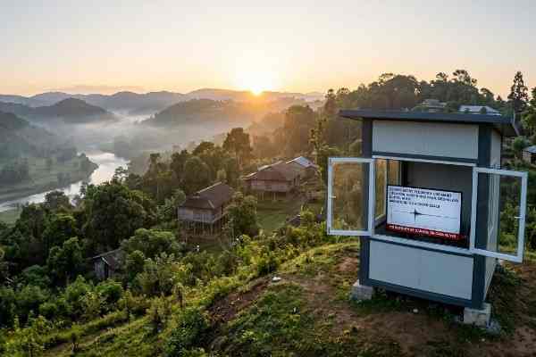
A mild earthquake measuring 2.8 on the Richter scale struck West Khasi Hills district of Meghalaya early Sunday morning. The tremor occurred at 6:50 AM IST at a depth of 10 km. Authorities reported no casualties, injuries, or property damage, while residents in some areas felt light shaking.
Quick Glance
- A 2.8-magnitude earthquake struck West Khasi Hills, Meghalaya, on Sunday morning.
- The tremor originated at a depth of 10 kilometres below the surface.
- No casualties, injuries, or structural damage have been reported.
- Meghalaya remains in Seismic Zone V, India’s highest earthquake-risk category.
Agartala/Shillong: A low-intensity earthquake rattled parts of Meghalaya’s West Khasi Hills district on Sunday morning. The tremor measured 2.8 on the Richter scale and occurred at approximately 6:50 AM IST.
The National Center for Seismology (NCS) confirmed the event through its official monitoring network. According to the agency, the earthquake originated at a depth of 10 kilometres, making it a shallow seismic event.
Although the magnitude remained low, residents living near the epicentre reported feeling mild vibrations. However, officials confirmed that the tremor caused no injuries, fatalities, or damage to infrastructure.
Authorities continue to monitor the situation. So far, no emergency response has been required.
Earthquake Details at a Glance
| Parameter | Details |
|---|---|
| Magnitude | 2.8 |
| Date | May 31, 2026 |
| Time | 6:50 AM IST |
| Location | West Khasi Hills, Meghalaya |
| Latitude | 25.488° N |
| Longitude | 90.995° E |
| Depth | 10 km |
| Casualties | None Reported |
| Property Damage | None Reported |
Why Even a Small Earthquake Can Be Felt
Experts explain that shallow earthquakes often become noticeable despite their low magnitude. Sunday’s tremor occurred only 10 kilometres beneath the earth’s surface.
As a result, residents near the epicentre experienced slight ground movement. Such earthquakes rarely cause significant damage unless accompanied by stronger seismic energy.
The National Center for Seismology also encouraged citizens to use its BhooKamp mobile application to access earthquake-related updates and safety information.
Meghalaya Remains Highly Vulnerable to Earthquakes
Meghalaya is one of India’s most seismically active states. The entire state falls under Seismic Zone V, the country’s highest earthquake-risk classification.
The region’s geological structure contributes significantly to frequent seismic activity. Meghalaya lies close to several active fault systems and tectonic boundaries that regularly generate earthquakes.
Consequently, minor and moderate tremors occur throughout the year. While most remain harmless, experts warn that the region retains the potential for stronger earthquakes.
Disaster management professionals continue to emphasize the importance of preparedness. They also advocate for earthquake-resistant construction practices and public awareness programs.
Northeast India Has a Long History of Major Earthquakes
Northeast India has experienced some of the strongest earthquakes recorded on the Indian subcontinent.
Among the most significant was the historic Shillong Plateau earthquake of 1897. The earthquake devastated large areas across the region and remains one of India’s most destructive seismic events.
Another major disaster struck in 1950 when the Great Assam Earthquake caused widespread destruction across Assam and neighbouring states.
These historical events continue to shape disaster preparedness strategies across Northeast India.
Recent Earthquake Activity Raises Attention
The latest tremor follows several other seismic events reported across Meghalaya in recent months.
On May 14, seismologists recorded a 2.7-magnitude earthquake in West Khasi Hills district. Earlier in March, a 2.9-magnitude tremor struck South West Khasi Hills district.
During the same month, monitoring stations also detected a stronger 3.4-magnitude earthquake in West Khasi Hills.
Scientists note that these repeated tremors reflect ongoing tectonic movements beneath the region. While most events remain minor, continuous monitoring remains essential.
Seismic Activity Continues Across Northeast India
Earthquake activity has not remained limited to Meghalaya. Several northeastern states have experienced tremors in recent weeks.
Reports indicate seismic movements in Nagaland, Manipur, and Arunachal Pradesh. These recurring earthquakes highlight the dynamic geological nature of Northeast India.
Experts say tectonic plate interactions beneath the region continue to produce seismic disturbances of varying intensity. Therefore, preparedness and public awareness remain crucial across the Northeast.
Although Sunday’s earthquake caused no damage, it serves as another reminder of the region’s vulnerability to seismic events. Authorities and disaster management agencies continue to encourage vigilance and readiness among residents.
People Also Ask (FAQ)
Was the Meghalaya earthquake on May 31, 2026 dangerous?
No. The earthquake measured 2.8 in magnitude and caused no casualties, injuries, or property damage.
Where did the earthquake occur in Meghalaya?
The epicentre was located in West Khasi Hills district at coordinates 25.488° N latitude and 90.995° E longitude.
Why does Meghalaya experience frequent earthquakes?
Meghalaya lies in Seismic Zone V and is located near active tectonic fault systems, making it highly prone to seismic activity.
