

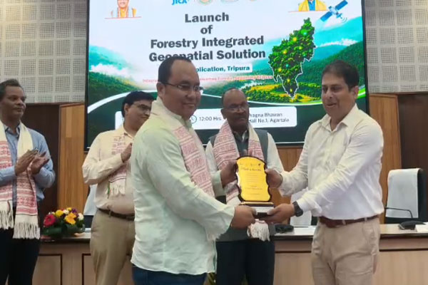
The Tripura Forest Department on Saturday launched the Forestry Integrated Geospatial Solution (FIGS), a technology-driven platform designed to modernize forest governance, improve natural resource management, and support livelihood planning across the state. Forest Minister Animesh Debbarma unveiled the system at Pragna Bhawan in Agartala in the presence of senior forest officials and stakeholders.
Quick Glance
- Tripura launched the Forestry Integrated Geospatial Solution (FIGS) under the SCATFORM project.
- The platform integrates GIS mapping, remote sensing, geo-tagging, and real-time monitoring tools.
- Around 300 mobile devices were distributed to strengthen field-level data collection.
- Officials expect the system to improve transparency, conservation planning, and livelihood management.
Agartala: The Government of Tripura has taken a major step toward modernizing forest administration by launching the Forestry Integrated Geospatial Solution (FIGS). Developed under the Tripura JICA Project, also known as SCATFORM, the platform combines advanced GIS and Management Information System technologies to support scientific decision-making and resource planning.
The launch ceremony took place at Pragna Bhawan in Agartala. Forests, Science and Technology Minister Animesh Debbarma inaugurated the platform. Senior forest officials, including Principal Secretary and Principal Chief Conservator of Forests R.K. Samal, attended the event along with representatives from the project and stakeholder groups.
Officials described the platform as a comprehensive digital tool that will help authorities manage forests more effectively while ensuring sustainable livelihood opportunities for forest-dependent communities.
Minister Highlights Role of Technology in Conservation
Addressing the gathering, Minister Debbarma emphasized that technology and nature should work together rather than be viewed as opposing forces.
He said modern conservation efforts require innovative tools that can strengthen environmental protection. According to him, technologies such as satellite monitoring, drones, mobile applications, and GIS-based analysis are already transforming forest management practices.
The Minister explained that satellite systems can detect forest fires, while mobile applications can geo-tag plantations. Likewise, drones can survey difficult terrains, and digital dashboards can monitor water conservation projects. Such tools allow authorities to understand environmental challenges more accurately and respond more efficiently.
He stressed that technology is not replacing nature. Instead, it is helping governments and communities protect natural resources more effectively.
FIGS Designed for Data-Driven Decision Making
The newly launched FIGS platform brings together multiple digital technologies under one integrated framework.
It combines GIS mapping, remote sensing, field-level data collection, geo-tagging, dashboard monitoring, approval workflows, and statistical reporting systems. As a result, officials can monitor forestry projects and livelihood programmes in real time.
The platform also marks a shift away from conventional reporting methods. Instead, it promotes transparency, accountability, and evidence-based planning through accurate geospatial intelligence.
Forest officials believe that the system will improve project implementation and enable faster policy decisions.
Focus on Livelihood Security for Forest Communities
A key feature of FIGS is its ability to support livelihood planning.
The Minister noted that nearly 70 percent of Tripura’s geographical area remains under forest cover. Consequently, a significant section of the state’s population depends directly or indirectly on forest resources for income and survival.
He explained that different regions possess different resource strengths. Areas with abundant water resources may be suitable for fisheries. Other locations may support agroforestry, livestock farming, bamboo-based industries, or eco-tourism initiatives.
Through detailed geospatial analysis, FIGS will help planners identify the most suitable livelihood opportunities for each region. This approach ensures that development interventions are based on actual ground conditions rather than assumptions.
Mobile Devices Distributed to Strengthen Field Monitoring
As part of the programme, authorities distributed 300 mobile devices to project personnel and field-level staff.
These devices will support real-time data collection, geo-tagging, and monitoring of project assets. Field officials can now update information related to plantations, nurseries, water conservation structures, and livelihood assets directly from project sites.
The initiative aims to improve the quality, accuracy, and speed of data reporting across districts.
Four Publications Released
During the event, dignitaries released four publications documenting the achievements of the SCATFORM project.
The publications focus on district-level achievements, biodiversity conservation, community-managed ecological landscapes, the FIGS operational guidebook, and success stories related to sustainable forest management.
These documents highlight progress in forest restoration, watershed development, biodiversity conservation, women’s livelihood initiatives, community participation, and digital innovation.
The programme also recognized Santanu Chakraborty, President of Neo Geo Info Tech Ltd., for his contribution to the development and successful deployment of the FIGS platform.
News Analysis
The launch of FIGS signals a significant policy shift in Tripura’s approach to forest governance. Rather than relying solely on traditional reporting systems, the state is moving toward real-time, technology-enabled monitoring and planning.
The initiative aligns with broader national efforts to incorporate geospatial technologies into environmental management. More importantly, it addresses two critical challenges simultaneously—forest conservation and livelihood security.
Since a large portion of Tripura remains forested, accurate data and scientific planning can directly influence the lives of thousands of forest-dependent families. The platform’s ability to identify region-specific livelihood opportunities may improve the effectiveness of government interventions and reduce resource misallocation.
If implemented effectively, FIGS could become a model for other northeastern states seeking to combine conservation goals with community development through digital innovation.
People Also Ask (FAQ)
What is the FIGS platform launched in Tripura?
FIGS, or Forestry Integrated Geospatial Solution, is a GIS- and MIS-based digital platform designed to improve forest governance, natural resource management, and livelihood planning.
Who launched the FIGS platform?
Tripura Forests, Science and Technology Minister Animesh Debbarma officially launched the platform at Pragna Bhawan in Agartala.
How will FIGS benefit forest-dependent communities?
The platform will help identify suitable livelihood opportunities based on geography, resources, and local needs, ensuring more effective and data-driven development planning.
What is the SCATFORM project?
SCATFORM is the Tripura JICA-supported Sustainable Catchment Forest Management Project that focuses on forest conservation, livelihood enhancement, and sustainable resource management.
